During my time at Georgia College, I was able to take courses in Geographic Information Systems (GIS), as well as Remote Sensing. In college, I wanted to do something different and not just follow everyone else. I heard from my peers that the GIS courses were difficult and that you will get lost very quickly. Luckily for me, I caught on quickly and enjoyed the classes. The classes were complex and there was a lot of information to be learned, so we had to move quickly to try and cover everything. After taking these courses, I feel better off about my career in the field of Geography, because I now have a focus.
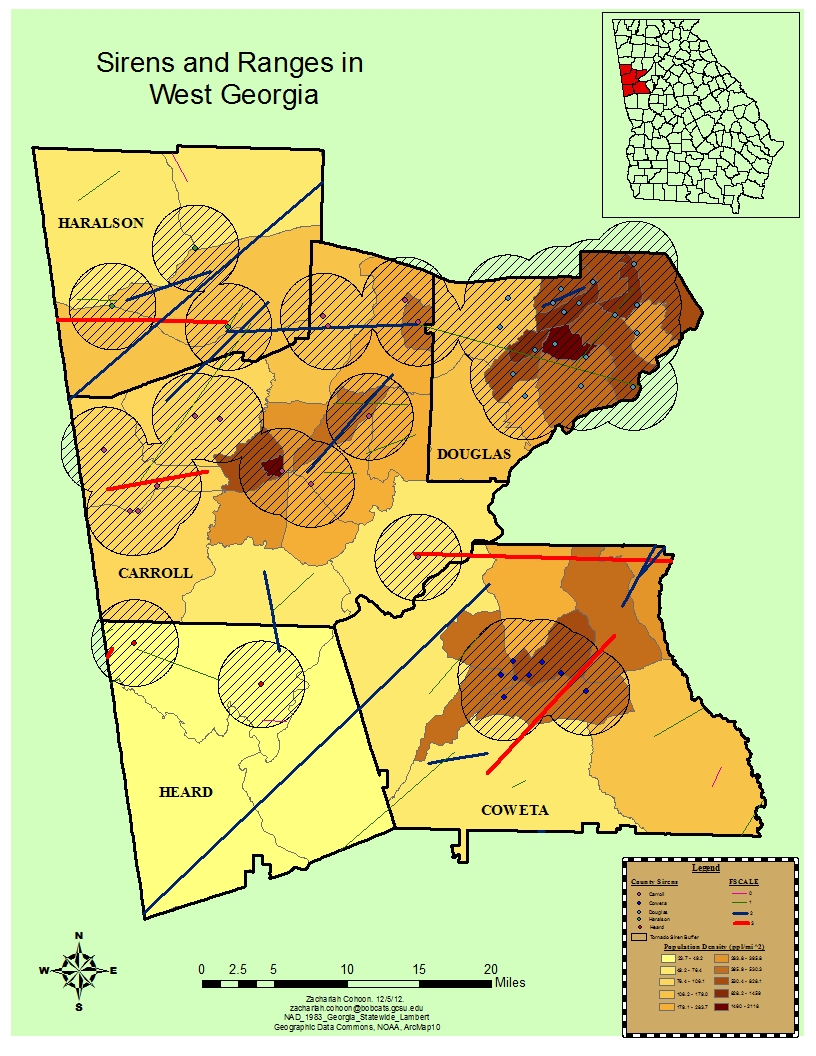
Map created to show sirens and ranges in West Georgia for the course GEOG 3100- Introduction to Geographic Information Systems, the introductory course. This map shows the amount of tornadoes in this particular area from (1950-2010), which are the colored lines, also representing the intensity of each tornado. Most importantly, this map shows the where the tornado sirens are in each county and shows the population density of each county. This map is useful as support for additional sirens in order to protect lives in zones that are not covered.
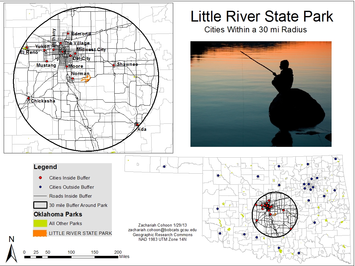
This map was developed for GEOG 4100 -Advanced Geographic Information Systems. Independent research was imperative due to the level of information required. Shown is a state park and the cities that are within a 30 mile radius. In a class competition, this map was voted as one of the top three in the class.
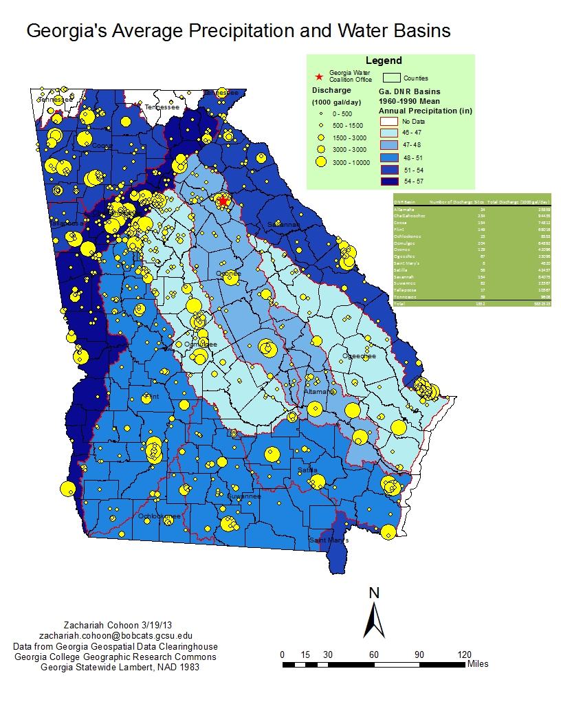
Georgia's Average Precipitation and Water Basins map displays the average precipitation and waste water discharge by the basin.
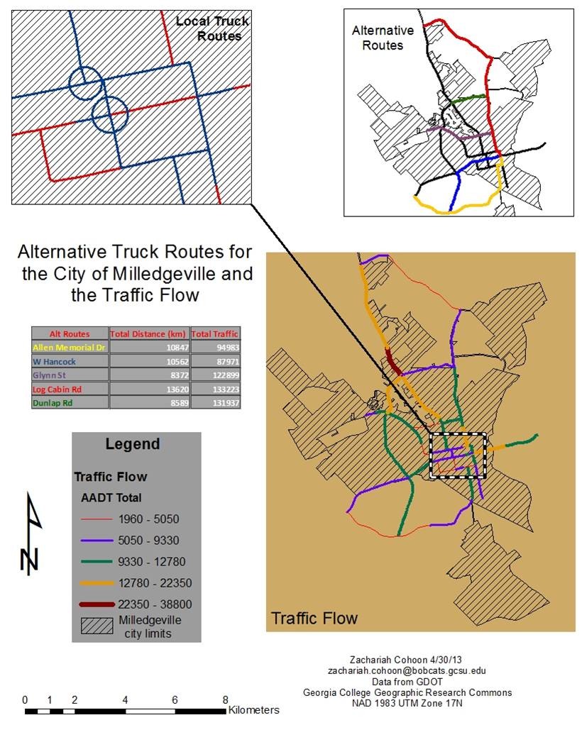
This map shows alternative truck routes for the city of Milledgeville, Georgia. To find the alternative routes for my project, I used ArcGIS Network Analyst, which provides network based spatial analysis such as routing, fleet routing, travel directions, closest facility, the shortest routes, and the most efficient routes. This project taught both my professor and I some new GIS skills, which ended up being necessary for my future work. The internship I completed during summer 2013 used Network Analyst to help us figure out the snow and ice sanding routes for their maintenance trucks. My experience with ArcGIS proved beneficial.
